
Maps & Directions
Overnight Camps at Eagle Lake
Directions for Overnight Programs Only
e.g. Base Camp, Ascent, Highlands, Crew
Rampart Range Road is a rough, winding gravel road. Allow one hour drive time from Colorado Springs.
Please Note: cell phone service is not available along much of Rampart Range Road; it is a good idea to print directions rather than rely on your smart phone’s GPS.
Directions from Colorado Springs
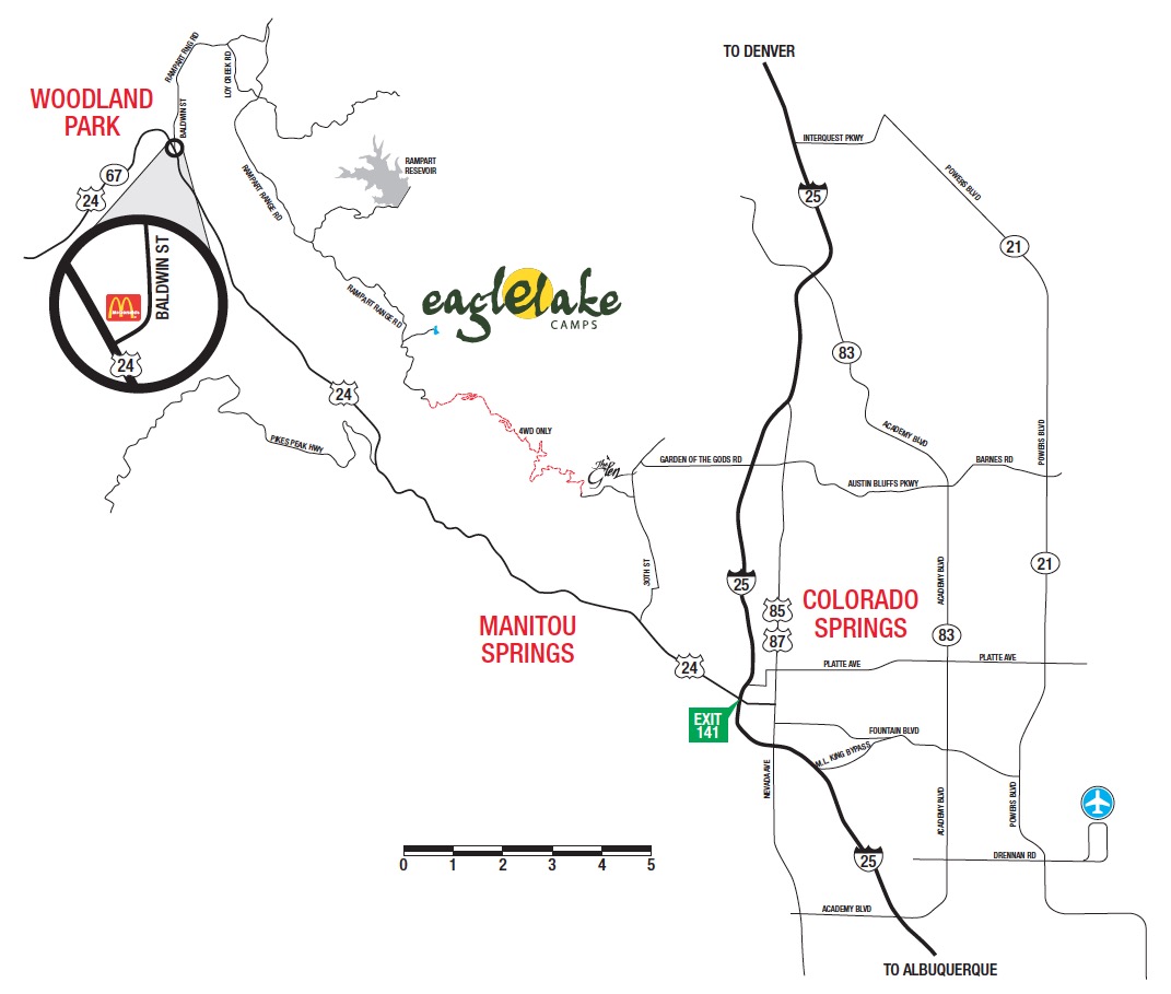
From Colorado Springs, follow Highway 24 West to Woodland Park
In Woodland Park, turn RIGHT on Baldwin Street (just before McDonald’s).
Stay on Baldwin for 2.5 miles (through 4 stop signs).
At fork in road, veer RIGHT onto Loy Creek Road.
Follow Loy Creek for 1.5 miles to Rampart Range Road.
Turn RIGHT onto Rampart Range Road (dirt road).
Follow Rampart Range for approximately 8 miles to Eagle Lake (on left side of road).
Please note: Rampart Range Road is a winding, rough, gravel road.
Please allow at least one hour drive time from Colorado Springs to Eagle Lake.
Directions using GPS
Enter the following coordinates into to your GPS unit:
38.933017, -104.961325
Note: entering Eagle Lake’s physical or mailing address into your GPS will not provide accurate directions. It is necessary to use the exact geo coordinates to acquire correct information.